Photo: Marthe Nyvoll / Visit Hammerfest
Long before measurement became a tool of science, it was a principle of wisdom. To measure did not simply mean to count or calculate. It meant recognizing an invisible order, perceiving the hidden harmony that holds heaven and earth together.
The ancients understood that the cosmos was not a chaotic collection of things, but an universe. literally, something turned toward the One, ordered by proportions, rhythms and correspondences. This is why geometry was regarded as a sacred discipline: it did not create the order of the world, but revealed the harmony already within it.
Every traditional civilization preserved some form of this intuition. The builder of a temple, the astronomer observing the movement of the stars, the priest aligning a sanctuary with the rising Sun, and the surveyor stretching a measuring cord across the fertile lands of the Nile were all participating in the same gesture: transforming physical space into an image of the cosmos.
Measurement, then, was never merely a technical exercise. It was a way of participating in the intelligence of Creation. Every measured angle, every drawn line and every calculated distance became a search for the order underlying the world. Precision was not simply mathematical accuracy; it was a form of fidelity to a Logos expressed through number, proportion and form.
Perhaps this is why one of the most fascinating achievements in human history was not the conquest of an empire, but the patient determination to measure the Earth itself. From the shadow of an obelisk observed by Eratosthenes on the banks of the Nile to the geodetic triangles that, more than two thousand years later, stretched across Europe and reached the Arctic in Hammerfest, there runs a single story: that of human beings looking at the sky, questioning geometry and trying to understand the measure of the world, and, in doing so, perhaps discovering something about themselves.

Photo: Mathia Pacenti / © WanderNorway
There are places that, at first glance, seem to belong to the very edge of the world. Hammerfest, in the far north of Norway, is one of them. For centuries, it has been regarded as one of the world's northernmost towns and cities, suspended between the Barents Sea, the northern lights and the endless light of the Arctic summer.
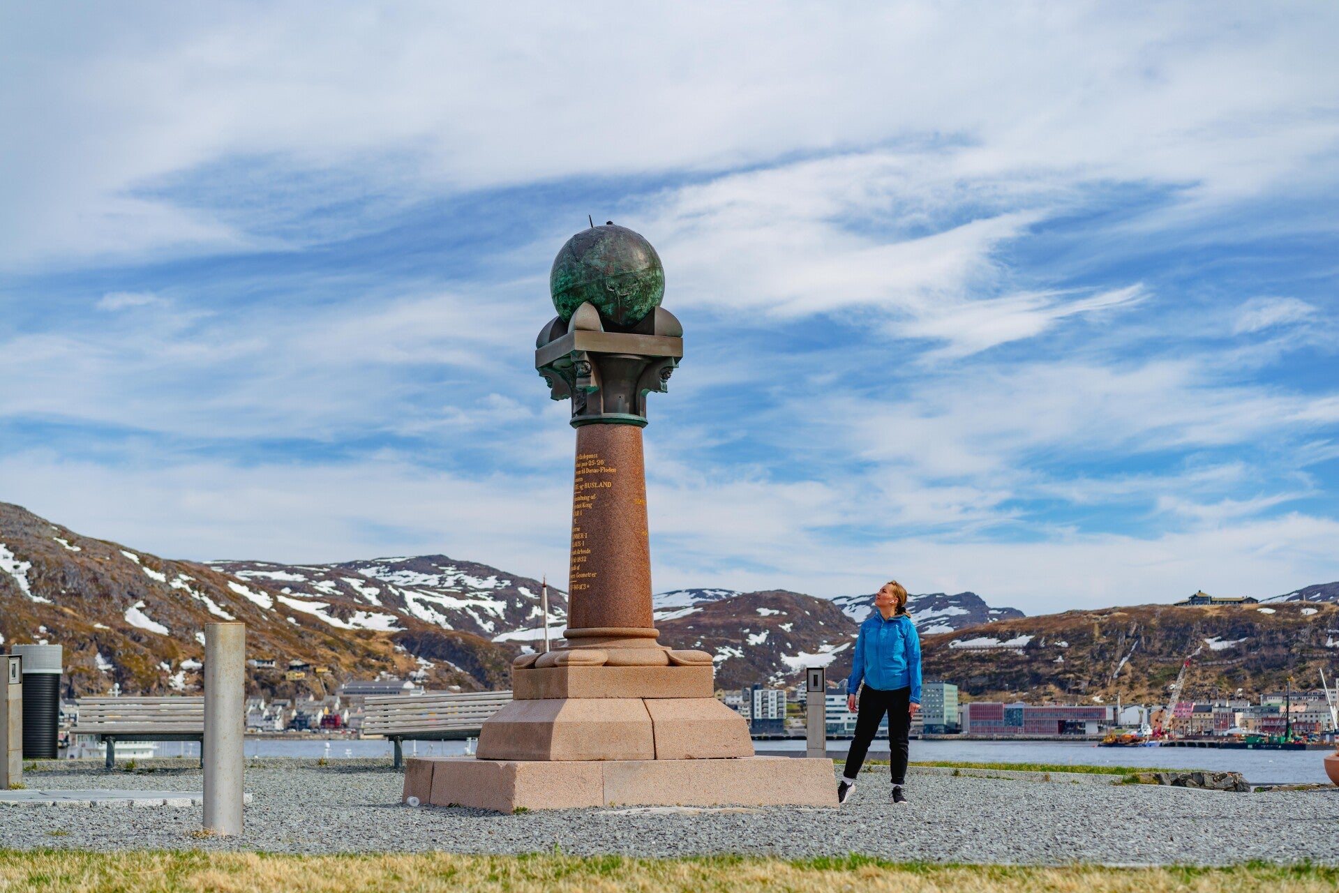
Yet here, in a place that may appear so remote, stands one of the most important monuments in the history of modern science: the Meridianstøtten, or Meridian Monument, at Fuglenes. It marks the northernmost point of the great Struve Geodetic Arc.
The monument does not commemorate a battle or celebrate a king. It commemorates an idea: the belief that the Earth itself could be understood through geometry. And that idea was already more than two thousand years old.
Long before satellites, GPS and images taken from space, a man named Eratosthenes of Cyrene had already worked out a way to measure our planet. In the 3rd century BC, as head of the famous Library of Alexandria, he developed a method that remains one of the most remarkable demonstrations of human reasoning.
Eratosthenes knew that in Syene, modern-day Aswan in Egypt, the Sun stood directly overhead at noon on the day of the summer solstice. Its rays reached the bottom of wells, while upright objects cast virtually no shadow.
At the same moment, however, an obelisk in Alexandria produced a small shadow.
By measuring the angle created by that shadow, approximately 7.2 degrees, or one-fiftieth of a full circle, and combining it with an estimate of the distance between the two cities, Eratosthenes was able to calculate the circumference of the Earth with astonishing accuracy.
He did not need to travel around the world. He needed only two cities, the Sun and geometry. In a sense, this was the beginning of scientific geodesy: the systematic attempt to measure and understand the shape and dimensions of the Earth.
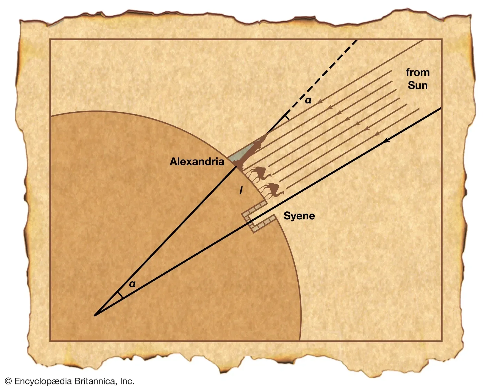
Photo: www.britannica.com
For almost two thousand years, no one substantially improved upon the basic principle of Eratosthenes' method. Then, during the 18th and 19th centuries, Europe embarked on an enormous scientific undertaking: to determine the actual shape of the Earth with ever greater precision.
It was no longer enough to know that the planet was spherical. Scientists wanted to understand how much it was flattened at the poles, determine its dimensions more accurately, calculate variations in curvature and, above all, create increasingly precise maps. This led to the great measurements of meridian arcs.
The most ambitious project was eventually coordinated by the astronomer Friedrich Georg Wilhelm Struve. Between 1816 and 1855, Struve and the teams working with him established a network of measurements extending for more than 2,820 kilometers, from the Arctic in the north to the shores of the Black Sea. Its northernmost point was established at Fuglenes, near Hammerfest. From there, an almost continuous chain of geodetic triangles stretched southward across the continent.
The principle behind triangulation is remarkably simple, yet extraordinarily ingenious. If one distance, known as a baseline, can be measured with great precision, the position of other points can then be calculated through a succession of triangles. Each mountain peak can become the vertex of the next triangle, each angle can be measured with a precision theodolite, and each new calculation provides the foundation for the next.
In this way, surveyors did not need to physically measure thousands of kilometers of difficult terrain. Instead, they could effectively carry a measurement across entire regions through geometry.
The Earth began to reveal itself as a vast geometric construction, and the landscape became part of the instrument used to understand it. Mountains were no longer simply mountains, but precise points in an immense mathematical figure stretching across the continent.
Today, obtaining a set of coordinates can be as simple as looking at a phone. In the nineteenth century, however, measuring the Earth meant undertaking expeditions that were almost heroic in scale.
Geodetic teams spent entire summers working in the mountains and remote landscapes of the north. They carried delicate instruments by hand or transported them by sled. They constructed wooden towers to make observation points visible across great distances and waited for weeks for fog, wind and rain to give them the few clear moments they needed.
Astronomical observations had to be repeated again and again. Errors accumulating over thousands of kilometers could compromise the entire project, making precision essential at every stage. It was not simply a technical challenge. It was a challenge against nature itself.
The project was also an extraordinary example of international cooperation. Astronomers, mathematicians, military officers and rulers from different states contributed resources and expertise to a common undertaking, creating a rare example of European scientific collaboration during the nineteenth century.
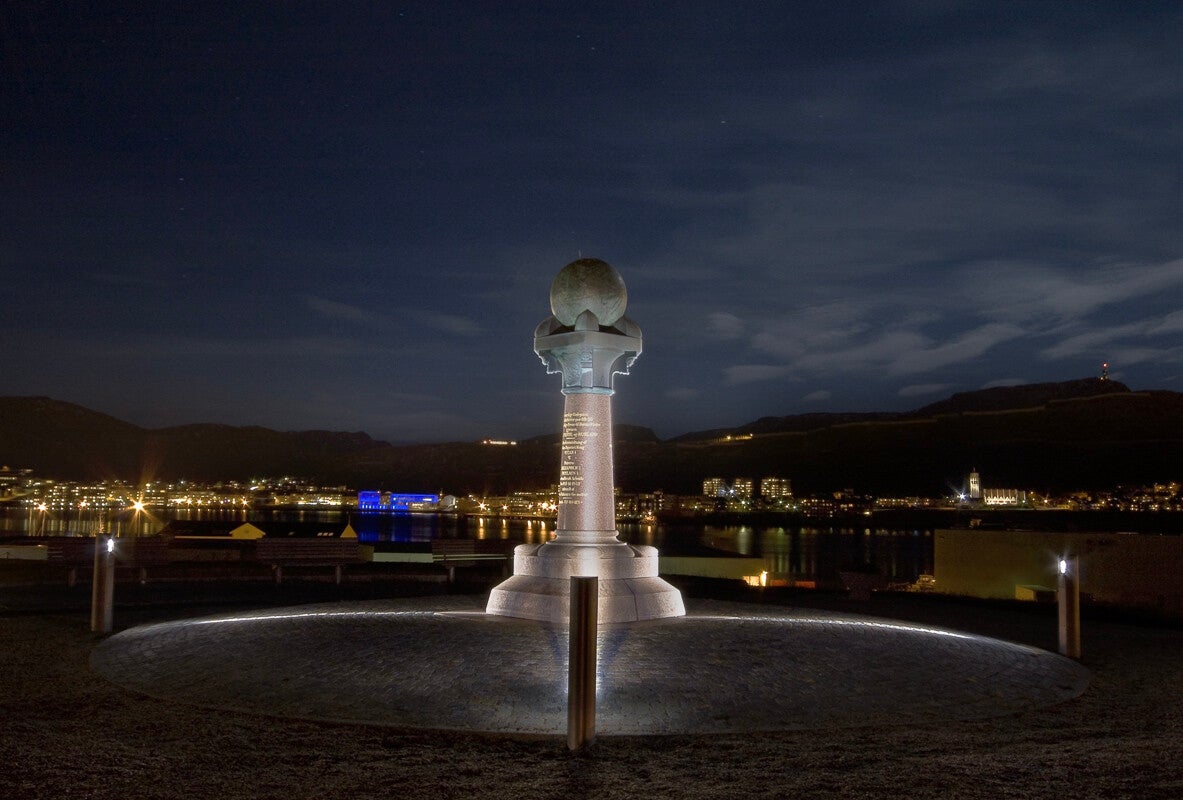
Photo: Beate Juliussen / www.nordnorge.com
There is an invisible thread connecting Hammerfest with Alexandria. At one end stands the simple shadow of an object used by Eratosthenes to reason about the size of the Earth. At the other is a vast network of 258 main triangles and 265 geodetic points extending through ten countries.
The principle, however, remains the same. Look at the sky. Measure the angles. Understand the Earth.
The Struve Geodetic Arc represents the monumental evolution of Eratosthenes' original intuition. Where the Alexandrian scholar used two cities, the nineteenth-century scientists used an entire continent. Where Eratosthenes observed the Sun and a simple shadow, Struve's project combined astronomy, mathematics and highly precise optical instruments. The scale had changed enormously, but the fundamental question had not.
Standing at the edge of the Arctic, the Meridian Monument in Hammerfest represents far more than a point along the Struve Geodetic Arc. It is a lasting symbol of humanity’s belief that, through observation, mathematics and measurement, we can make sense of the world around us. It is this remarkable combination of scientific ambition, international cooperation and human ingenuity that led UNESCO to inscribe the Struve Geodetic Arc on the World Heritage List in 2005, recognizing it as an extraordinary achievement in the history of modern science.
There is something deeply poetic about the geographical and intellectual journey represented by the arc. Its story can be imagined as beginning symbolically in ancient Egypt, with the shadow of an obelisk in Alexandria and the Sun standing directly overhead in Syene, and reaching one of its most extraordinary expressions in the far north of Europe, among the mountains and Arctic landscapes of Norway.
Two worlds separated by immense distances. Two moments in history more than two thousand years apart. And one enormous question connecting them: How large is the Earth we inhabit?
The answer was not discovered through power or conquest, but through patience, mathematics and the extraordinary ability of the human mind to transform a ray of sunlight, a measured shadow and a succession of triangles into a way of understanding the world.
Perhaps that is the enduring meaning of the Meridian Monument in Hammerfest. It reminds us that sometimes the greatest journeys are not those that take us across the Earth, but those that teach us how to measure the ground beneath our feet and, through it, recognize our place within something much larger than ourselves.